Zeitlin Sotheby's International Realty  ·  615.383.0183  ·  Each office is independently owned and operated.
Middle Tennessee Land Guide

Robertson County Land for Sale — Buyer's Guide

Live Market Data · Scenic Land Intelligence Explore live →

Robertson County — Closed Transaction Data

Based on verified closed land transactions in Robertson County. Pulled live from the Scenic Land Intelligence database — updates automatically as new closings are recorded.

Median $/Acre
Typical Range (P25–P75)
Median Tract Size
Median Days on Market
Closed Transactions

Live data — pulled at page load from the Scenic Land Intelligence transaction database. Median $/acre is the midpoint of all qualified closings (tracts 1+ acres); P25–P75 is the typical range (middle 50%). Outliers above $5M/acre and below $100/acre excluded.

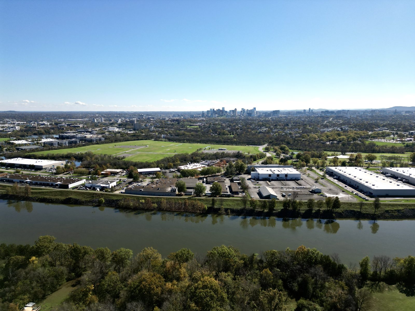
Robertson County is where Nashville's northward expansion meets some of the most productive agricultural ground in the state. Springfield serves as the county seat and commercial center, while White House and Coopertown absorb the I-65 growth pressure that has reshaped land values along that corridor. Further north toward Adams and the Kentucky line, you're in classic dark-fired tobacco country — well-managed land, deep soils, and a farming tradition that stretches back generations. This guide covers what buyers need to know before they write an offer on Robertson County land: zoning districts, lot size requirements, septic considerations, greenbelt enrollment, utility availability, and where the market stands today.

This page is part of our county-by-county land buyer's resource series. For a broader introduction to buying land in Middle Tennessee, see our Land Buyer's Guide. For adjacent county comparisons, our Sumner County land guide covers the market immediately to the east. Questions about a specific parcel? Contact us directly — we know the Robertson County market well.

← Back to All County Guides
Terrain at a Glance

What the land itself is telling you.

In Robertson County, Tennessee, the land stretches across a gently rolling limestone plateau within the Highland Rim, where elevations range from 374 to 961 feet above sea level. The terrain is defined by the Western Pennyroyal Karst — a landscape of sinkholes, closed depressions, and broad undulating uplands at 600–800 feet, cut by the Red River corridor's moderately dissected stream valleys that incise 100–200 feet into the plateau surface. The Red River, Sulphur Fork, and South Fork Red River drain the county northward into Kentucky, while Cedar Hill Swamp and Port Royal State Park anchor pockets of ecological significance. Deep, well-drained Crider, Pembroke, and Dickson silt loams — developed on loess over limestone — deliver some of the most productive agricultural soils in Middle Tennessee, supporting 71% cropland, 14% pasture, and 8% woodland across more than 200,000 acres of active farmland.

Robertson County — Quick Facts

Physiographic Region
Interior Low Plateaus — Highland Rim / Western Pennyroyal Karst
Elevation Range
374–961 ft above sea level
Area
476 sq mi · County seat: Springfield
Dominant Landforms
Robertson County occupies the Western Pennyroyal Karst section of the Highland Rim — a gently rolling to undulating limestone plateau at 600–800 feet, punctuated by karst sinkholes, closed depressions, and moderately dissected stream valleys along the Red River corridor. Relief is low to moderate, with stream incisions of 100–200 feet. The terrain is consistent with the broader Interior Low Plateaus character: fertile uplands giving way to narrow alluvial bottomlands.
Major Waterways
Red River, Sulphur Fork Red River, South Fork Red River, Cedar Hill Swamp
Dominant Soils
Crider, Pembroke, Dickson silt loams (Alfisols); well-drained loess-over-limestone profiles suited for row crops, hay, and tobacco; Nolin series on Red River floodplains
Land Use
71% cropland, 14% pasture, 8% woodland, 7% other (on farmland; 200,408 total farm acres — 66% of county land per 2022 USDA Ag Census)
Jump to Section
Section 01

Minimum Lot Sizes & Zoning Districts

Robertson County's unincorporated land is primarily governed by the A-1 Agricultural district. The county has less published regulatory documentation than neighboring metro-adjacent counties — buyers should confirm current minimum lot sizes directly with the Robertson County Planning Department in Springfield before making assumptions.

Partial Data
A-1 — Agricultural

Agricultural District — Primary Rural Zone

The A-1 Agricultural district is the governing zoning classification for the vast majority of unincorporated Robertson County. It encompasses farmland, rural residential uses, and open ground outside the incorporated municipalities. Robertson County has historically maintained a lighter regulatory framework than more urbanized Middle Tennessee counties, which is part of its appeal for farm and estate buyers. Published minimum lot size requirements for the A-1 district are not fully documented in publicly accessible county ordinance materials — contact the Robertson County Planning Department for current standards before proceeding with any purchase or subdivision analysis.

Key FactA-1 is the dominant district for unincorporated Robertson County · Contact county planning for current minimums
Special Exception Threshold

5-Acre Special Exception Requirement

Robertson County's zoning framework includes a 5-acre threshold for certain uses that require a special exception under the applicable ordinance. This 5-acre standard is a meaningful reference point for buyers evaluating smaller rural parcels — uses that don't meet this threshold may require additional approval steps. Buyers considering parcels under 5 acres in unincorporated Robertson County should verify what uses require special exception approval under current county rules. This is particularly relevant for agricultural structures, accessory buildings, or non-standard residential configurations on smaller tracts.

Verified5-acre special exception threshold confirmed · Source: robertsoncountytn.gov (partial)
R-1 / R-2 — Residential

Residential Districts Near Municipalities

R-1 and R-2 residential zoning districts apply in areas near Robertson County's municipalities and established suburban-edge communities. These districts govern single-family residential development with standards appropriate to lower-density residential neighborhoods. As with the A-1 district, specific lot size minimums for R-1 and R-2 are not comprehensively published in accessible county documents — the Robertson County Planning Department is the authoritative source for current lot area requirements, setbacks, and dimensional standards in these districts.

Key FactR-1 and R-2 apply near towns · Specific minimums not fully published — verify with county planning
Municipal Jurisdictions

White House, Coopertown, Cross Plains

White House, Coopertown, and Cross Plains maintain their own municipal utility systems and have their own planning and zoning standards separate from the unincorporated county. Buyers purchasing within these municipal boundaries are subject to each municipality's individual zoning ordinance, not the county's. White House in particular has seen significant growth and its land use regulations have evolved accordingly. If a parcel is within or adjacent to any of these municipal limits, confirm which jurisdiction's rules apply before relying on county zoning information.

Key FactWhite House, Coopertown, Cross Plains have separate municipal zoning · Not governed by county A-1/R-1/R-2 rules
Regulatory Complexity

Less Complexity Than Metro Counties

Robertson County's regulatory environment is genuinely less complex than the counties immediately surrounding Nashville — Davidson, Williamson, and Rutherford all have more stratified zoning codes, more frequent plan amendments, and more active land use disputes. For buyers who have experienced the regulatory friction of purchasing land closer to Nashville, Robertson County can feel relatively straightforward by comparison. That said, less complexity does not mean no requirements — and because documentation is less thoroughly published, direct communication with the planning office is more important here than in counties with comprehensive online portals.

Key FactLighter regulatory framework than metro counties · Fewer zoning districts, less published documentation
Data Transparency Note

Verify All Minimums With County Planning

We are transparent about the limits of what can be confirmed from publicly available sources. Robertson County's zoning minimums are not as comprehensively documented online as neighboring Sumner County's 2023 Zoning Resolution or Williamson County's detailed code. The data on this page reflects what has been partially confirmed through robertsoncountytn.gov, but general minimum lot size figures for A-1, R-1, and R-2 were not definitively published in the county's accessible materials at the time of writing. Call the Robertson County Planning Department at the Springfield courthouse before making any lot-size-dependent decisions.

Data NotePartial verification from robertsoncountytn.gov · County planning office is the authoritative source
Our Take

Robertson County's planning documentation is thinner online than what you'll find in Sumner or Williamson. That's not a red flag — it reflects a county that hasn't needed to publish everything digitally because the regulatory environment is simpler. But it does mean you need to pick up the phone and call the planning office before you assume anything about what you can do with a parcel. I've walked buyers through this process many times — the Robertson County planning staff are accessible and helpful. Don't skip that call. And if a seller or their agent makes specific lot-size claims, ask for documentation. It's easy enough to verify, and the county is responsive.

Section 02

Septic & Sewer

The vast majority of Robertson County outside its municipalities operates on individual septic systems. The county's loamy agricultural soils are a genuine advantage here — Robertson County land tends to perc well compared to counties with more challenging geology, making septic more predictable and less expensive to install.

Septic-Dominant County
Municipal Sewer Coverage

Where Sewer Is Available

Sewer infrastructure in Robertson County is concentrated in its incorporated municipalities. Springfield, the county seat, has municipal sewer serving its commercial and residential areas. White House has its own utility system with sewer coverage. Coopertown also maintains its own utilities. Outside these municipal service areas, the unincorporated county is on individual septic systems — and that accounts for the substantial majority of the county's acreage. Buyers purchasing rural or agricultural land in Robertson County should assume septic, not sewer, unless a parcel is explicitly within a municipal service area boundary.

Sewer AreasSpringfield, White House, Coopertown have municipal sewer · Rural county is septic
Soil Conditions

Why Robertson County Percs Well

Robertson County's agricultural soils are among its most valuable assets — and that value extends to septic performance. The county is known for deep, loamy soils that have supported dark-fired tobacco cultivation and row crop farming for generations. These soil profiles tend to drain well and perc reliably, which is a meaningful advantage compared to counties with limestone karst geology, shallow rock, or heavy clay that complicates septic installation. On well-managed farm ground in Robertson County, perc testing generally produces favorable results. This makes lot yield more predictable and keeps septic system costs reasonable on rural tracts.

Soil AdvantageLoamy agricultural soils generally perc well · More predictable than karst or clay counties
TDEC Requirements

State Septic Standards Apply Countywide

All septic installations in Robertson County, as throughout Tennessee, are governed by the Tennessee Department of Environment and Conservation (TDEC). TDEC approval is required before any building permit can be issued on a parcel relying on individual septic. The approval process begins with a perc test conducted by a qualified site evaluator. TDEC's minimum lot size for a conventional septic system is determined by soil conditions — not a fixed acreage — but most rural tracts of 2 acres or more on Robertson County's agricultural soils are strong candidates for approval. Always commission a perc test before going under contract on any parcel without confirmed sewer access.

Key FactTDEC governs all septic permits · Perc test required before building permit on any rural parcel
Our Take

Septic in Robertson County is genuinely less of a headache than in counties where you're fighting karst geology or heavy clay. The agricultural soils here have been cultivated for over a century — they're well-drained, deep, and they perc. I've seen buyers walk away from land in Wilson or Sumner counties because perc tests came back marginal on limestone-heavy soils. That's a much rarer conversation in Robertson County on legitimate farm ground. That said, still run the perc test — always — before you commit to a price. Soil conditions vary within the county, and no due diligence step is optional. But you're statistically in better shape here than in most of our neighboring counties on the septic question.

Section 03

Greenbelt Tax Assessment

Robertson County is one of Tennessee's premier dark-fired tobacco producing counties — a distinction that has defined land management practices here for generations. Greenbelt enrollment is nearly universal on farm tracts, and the genuine agricultural use required to qualify is the actual economic reality for most rural landowners in the county.

Strong Ag Identity
State Law Minimums

Tennessee Greenbelt Requirements

Tennessee's Agricultural, Forest, and Open Space Land Act of 1976 provides significantly reduced property tax assessments for qualifying land. To qualify for agricultural greenbelt enrollment, a tract must meet a 15-acre minimum and demonstrate qualifying income or a 25-year farming history (the income threshold is $1,500 average annual income over 3 years). Open space land qualifies at a lower threshold of just 3 acres. Forest land requires 15 acres. The maximum enrollment is 1,500 acres per county per owner. When Greenbelt land is converted to a non-qualifying use, rollback taxes are assessed for the 3 most recent tax years — a real cost that should be factored into any negotiation on farm ground.

State MinimumsAgricultural / Forest: 15 acres · Open space: 3 acres · Rollback: 3 years back taxes on use change
Dark-Fired Tobacco Heritage

Tennessee's Premier Tobacco County

Robertson County is nationally recognized as one of the top dark-fired tobacco producing counties in the United States — a designation that carries real agricultural significance. Dark-fired tobacco requires specific soil conditions, curing infrastructure, and farming knowledge that has been passed down through Robertson County families for generations. This farming heritage means the land here has been actively worked and well-maintained, not neglected. Tracts with established tobacco history typically have the soil management, barn infrastructure, and agricultural credential record that makes Greenbelt qualification straightforward. Row crops, cattle grazing, and hay production are also prominent and widely enrolled.

Key FactOne of TN's premier dark-fired tobacco counties · Tobacco, cattle, and hay all qualify for Greenbelt
Rollback Exposure

What Changes at Conversion

When Robertson County farmland enrolled in Greenbelt is converted to a non-qualifying use — whether through development, subdivision, or a change in agricultural activity — the county assesses rollback taxes for the 3 most recent tax years at full market assessed value rather than the reduced agricultural rate. As Robertson County land values have appreciated — particularly near White House and Coopertown where growth pressure is strongest — the dollar amount of rollback exposure has grown accordingly. Any buyer acquiring Robertson County farm ground should confirm the current Greenbelt enrollment status, calculate the potential rollback liability, and negotiate responsibility for that rollback in the purchase contract.

Key Fact3-year rollback on use change · Negotiate rollback responsibility before contract · Values have risen near growth corridors
Our Take

Greenbelt in Robertson County isn't a tax strategy layered onto otherwise idle land — it reflects genuine, multigenerational agricultural use. When I'm showing a buyer a Robertson County farm tract that's been in dark-fired tobacco for 40 years, the Greenbelt enrollment is telling you something real about how that land has been managed. That's different from a suburban county where landowners enrolled marginal grass fields to save on taxes. The agricultural credential here means something. What I always flag for buyers: confirm the rollback number before you close, and decide who carries it. On a 100-acre tract near White House where values have moved significantly, that 3-year rollback is not a rounding error.

Robertson County Tennessee agricultural farmland aerial view
Section 04

Zoning Districts & Special Provisions

Robertson County's zoning structure is straightforward compared to the urbanized counties surrounding Nashville. Agricultural (A-1) dominates unincorporated areas, residential districts cluster near the county's towns, and commercial zoning follows the major highway corridors. Less complexity means faster land use research — which buyers familiar with Williamson or Davidson counties will find refreshing.

Straightforward Framework
A-1 — Agricultural

Agricultural District — Dominant Classification

The A-1 Agricultural district covers the bulk of unincorporated Robertson County. It governs farming, animal husbandry, forestry, and related rural land uses that have defined this county's character for more than a century. The A-1 classification is appropriate for nearly all the farm and estate ground that buyers are targeting in Robertson County — dark-fired tobacco operations, cattle farms, hay ground, and rural residential estates all fall comfortably within A-1. The district's broad agricultural scope means it accommodates active farming while also permitting compatible residential uses, making it the natural landing zone for buyers who want working farm ground with a home site.

CoverageDominant district across unincorporated Robertson County · Encompasses farming, residential, and compatible rural uses
R-1 / R-2 — Residential

Residential Districts Near Towns

R-1 and R-2 residential zoning applies in areas surrounding Robertson County's municipalities and in established residential communities throughout the county. These districts are designed for single-family residential development and reflect the lower-density suburban character of areas adjacent to Springfield, White House, Coopertown, and Cross Plains. R-1 generally represents lower density single-family use; R-2 allows for slightly higher density residential development. Buyers purchasing land in or near these districts should obtain current dimensional standards directly from the county planning office, as specific lot size minimums are not comprehensively published in accessible online documentation.

CoverageR-1 and R-2 near municipalities · Contact county planning for specific dimensional standards
Commercial Corridors

Commercial Zoning Along Key Routes

Commercial zoning in Robertson County follows the county's principal highway corridors — US-431 (the main Springfield-to-Nashville route), US-41, and the I-65 interchange area near White House. The White House interchange at I-65 has seen the most active commercial land interest, driven by the community's rapid population growth and its position as a distribution and light industrial hub. Commercial zoning along US-431 through Springfield provides the county seat with retail, service, and light commercial land use options. Buyers interested in commercial or mixed-use Robertson County land should verify specific district classifications along these corridors, as commercial zoning patterns shift with each road improvement and municipal annexation cycle.

Key CorridorsUS-431, US-41, I-65 at White House · Most active commercial interest near White House interchange
Comparison to Metro Counties

Why Robertson County Is Easier to Research

Buyers who have navigated land use research in Davidson, Williamson, or Rutherford counties will find Robertson County comparatively simple. Those metro-adjacent counties have layered zoning codes with dozens of districts, overlay zones, detailed site plan requirements, and active political environments around land use decisions. Robertson County's framework is more limited in scope — fewer districts, fewer overlays, and a regulatory culture that reflects a county that is still predominantly rural. The tradeoff is less published documentation available online. But for experienced land buyers, that simplicity is generally a feature, not a limitation. What you lose in digital documentation, you gain in a more predictable and accessible planning environment.

Key AdvantageFewer districts and overlays than metro counties · Simpler research process for experienced buyers
Our Take

Robertson County zoning research takes a fraction of the time that Williamson County takes. In Williamson, you're reading hundreds of pages of code, checking overlay districts, calling planning staff about policy interpretations, and watching the political environment for plan amendments. In Robertson County, A-1 covers most of what you're buying, the framework is well-established, and the planning office is accessible. I'm not saying it's lawless — the county has real zoning and it enforces it. But for buyers who've been through the Williamson County gauntlet, Robertson is a different experience. That simplicity makes due diligence faster and cheaper. That has value.

Section 05

Utilities & Infrastructure

Robertson County's utility infrastructure is adequate for rural land ownership but not exceptional — TVA power through local cooperatives is broadly available, natural gas is limited outside the municipalities, rural water districts serve portions of the county, and fiber internet deployment is underway but concentrated near the growth corridors at White House and Coopertown.

Verify Per Tract
Electric

TVA Power Through Local Cooperatives

Electric service throughout Robertson County is delivered through TVA-sourced power via local electric cooperatives. Robertson County Electric Membership Corporation (RCEMC) is the primary electric cooperative serving unincorporated areas of the county, with municipal utilities operating in incorporated areas. TVA-backed cooperative power means electric access is broadly available across rural Robertson County, including on agricultural tracts far from any population center. Extension costs to remote parcels can vary depending on distance from existing lines, but electric access is generally not a limiting factor for rural land buyers in this county. Confirm service availability and estimated extension costs with RCEMC for any specific parcel before closing.

ProviderRobertson County Electric Membership Corporation (RCEMC) · TVA-sourced power · Broadly available
Water

Rural Water Districts and Wells

Public water availability in unincorporated Robertson County is served by a combination of rural water districts that cover portions of the county. Coverage is not uniform across the county, and rural tracts — particularly in the northern areas near the Kentucky line — may not have public water lines on the road. When public water is unavailable, well drilling is the standard solution. Robertson County's agricultural soil profiles and hydrogeology are generally supportive of productive well installations, though depth and yield will vary by location. White House and Coopertown maintain their own municipal water systems. Verify water availability and source for any specific parcel before making purchase decisions — utility mapping at the county level is your starting point, but confirmation from the relevant district is required.

Key FactRural water districts cover parts of county · Wells common on rural tracts · Verify availability before contract
Natural Gas

Limited Outside Municipalities

Natural gas distribution in Robertson County is concentrated within or near the incorporated municipalities — Springfield, White House, and Coopertown have access to natural gas service. Outside these municipal areas, natural gas is generally not available on rural tracts, and propane is the standard alternative for space heating, water heating, and cooking at rural home sites and farm operations. Buyers planning for residential use on rural Robertson County land should budget for propane infrastructure — tank installation, initial fill, and the ongoing logistics of propane delivery from regional suppliers. This is the standard setup for rural farm ownership throughout Middle Tennessee and is not unique to Robertson County.

Rural StandardNatural gas near municipalities only · Propane is the norm for rural tracts · Plan accordingly
Internet & Broadband

Fiber Deployment Underway Near Growth Areas

Broadband infrastructure in Robertson County reflects its transitional character — near White House and Coopertown, where residential growth has been strongest and the population base justifies investment, fiber deployment is actively underway and coverage is improving. Further into the rural county — toward Springfield, Adams, Cedar Hill, and the northern tier — internet infrastructure is more limited and coverage gaps persist. Satellite internet services have improved the baseline for many rural property owners, but buyers who depend on reliable high-speed internet for remote work should verify broadband availability specifically for any target parcel before committing. The county's broadband situation is reasonable but not exceptional relative to rural Middle Tennessee as a whole.

CoverageFiber expanding near White House and Coopertown · Gaps persist in rural northern county · Verify before purchase
Our Take

The utility question I get most often from buyers looking at Robertson County is internet. It's a legitimate concern — if you're buying a farm in the northern part of the county with plans to work from home, you need to know what service is available at that address before you close, not after. I always pull broadband availability data for any rural parcel we're evaluating. Near White House and Coopertown, the situation has improved significantly in the last few years. Northern Robertson and the areas around Springfield are spottier. Starlink has changed the calculus for many buyers — it's a real option now for remote rural locations — but confirm terrestrial options first and factor the infrastructure cost into your offer if you need to build it from scratch.

Section 06

Sub-Areas & Key Corridors

Robertson County operates as several distinct land markets depending on location — the I-65 corridor at White House trades at prices driven by Nashville growth pressure, Springfield and surrounds offer more moderate values with county seat amenities, Coopertown is seeing residential growth from Nashville commuters, and northern Robertson remains the county's most rural and most agricultural ground.

Know Your Area
White House / I-65 Corridor

Fastest Growth in Robertson County

White House is the fastest-growing community in Robertson County and one of the more active growth nodes in Middle Tennessee. Its position at the I-65 interchange — accessible to both Nashville and the I-65 growth corridor that continues north toward Bowling Green — has made it a destination for residential development, light industrial activity, and distribution logistics. Parcels near the White House interchange have already repriced to reflect development premium. Land values here track closer to suburban Nashville pricing than to traditional Robertson County farm economics. Buyers looking for farm-priced ground will not find it in the White House corridor; buyers looking for growth-driven land investments will find an active and competitive market.

Market CharacterHighest land values in Robertson County · Development premium near I-65 interchange · Nashville spillover driving demand
Springfield & Surrounds

County Seat With Moderate Values

Springfield is Robertson County's governmental and commercial hub. It has some sewer access, county services, commercial amenities, and the institutional infrastructure that comes with being a county seat. Land values in and immediately around Springfield are moderate — not as elevated as the White House corridor, but not at the agricultural floor pricing of the far northern county. Springfield has seen modest commercial investment in recent years and some residential development driven by its position as the primary service center for the county. Buyers looking for land with sewer access and proximity to county services will find better options in Springfield than anywhere else in unincorporated Robertson County.

Market CharacterCounty seat · Moderate land values · Some sewer access available · Commercial services present
Northern Robertson (Toward Kentucky)

Classic Dark-Fired Tobacco Country

The northern tier of Robertson County — Adams, Cedar Hill, Orlinda, and the areas approaching the Kentucky state line — is where the county's agricultural heritage is most intact. This is the heart of Tennessee's dark-fired tobacco belt, and the land here reflects generations of active farming. Soils are productive, farm infrastructure is established, acreage is substantial, and prices still reflect farming economics rather than Nashville suburban speculation. For buyers who genuinely want 50 to 200 acres of working agricultural ground at prices that make farming sense, northern Robertson County is one of the best options remaining within a reasonable distance of Nashville. Drive times from downtown Nashville run 60 to 75 minutes depending on destination, but the land character is genuinely rural.

Market CharacterLowest prices in Robertson County · Most productive agricultural ground · Genuine rural character · 60–75 min from Nashville
Eastern Robertson (Coopertown Area)

Growing Residential Interest

Coopertown occupies eastern Robertson County and benefits from its proximity to both Nashville and the White House growth corridor. Nashville commuters have discovered Coopertown — drive times to the Nashville urban core are manageable, and land prices have not yet reached the premium levels of White House or the immediate suburban ring. The Coopertown area has newer utility infrastructure, including its own municipal water system, and is attracting residential buyers who want more space than the Nashville suburbs offer without fully leaving the metropolitan sphere. Land prices here are rising as awareness increases, and the combination of commuter accessibility and relative affordability is a dynamic that compresses over time.

Market CharacterGrowing residential interest · Nashville commuter accessible · Newer utilities · Prices rising from lower base
Our Take

If you're shopping Robertson County, clarity on which sub-area you're buying in matters more than almost anything else. White House and Coopertown are priced differently than Springfield, and northern Robertson is priced differently than all of them. I've had buyers come in expecting farm prices on land near the White House interchange — that ship has sailed. The north county is where farm pricing still lives. If your goal is genuine agricultural ground within a reasonable drive of Nashville, I'd point you north of Springfield toward Adams and Cedar Hill. That's the ground that hasn't fully repriced yet, and it's the best of what Robertson County has to offer for a legitimate farming buyer.

Section 07

Market Overview & Buyer Considerations

Robertson County is absorbing Nashville's northward growth pressure in real time — White House and Coopertown are leading the repricing, while the rural agricultural interior remains meaningfully more affordable. Farmland values are rising as Davidson County buyers look north and discover what Robertson County offers at a fraction of the price per acre they'd pay closer to Nashville.

Active Market
Pricing

Price Per Acre Ranges

Robertson County land trades across a wide range depending on location, improvements, and proximity to growth corridors. The county's price range runs approximately $7,000 to $30,000 per acre across different sub-areas and use types. The low end of that range reflects genuine agricultural ground in the northern county without premium improvements. The high end reflects land with development potential, interstate proximity, or municipal service access — primarily in the White House and Coopertown corridors. Agricultural land in mid-county trades in the middle of that range. These figures represent raw land pricing — improved estates, parcels with significant infrastructure, or waterfeature properties will command premiums above this range.

Price Range$7,000–$30,000 per acre depending on location, use, and proximity to growth corridors
Growth Drivers

What Is Moving Robertson County Land

Three forces are reshaping Robertson County land pricing. First, Nashville's northward suburban expansion is driving residential demand into White House and Coopertown from buyers who cannot afford closer-in suburban land. Second, Davidson County farmland buyers — squeezed by urbanization — are actively looking north into Robertson County for agricultural land at prices that still reflect farming economics. Third, the I-65 corridor's industrial and logistics development continues to attract distribution, light manufacturing, and employment-generating investment that raises surrounding land values. The combination of these forces is creating differential pricing pressure — strongest near the growth corridors, gentler but real in the agricultural interior.

Key DriversNashville northward expansion · Davidson County buyers displaced north · I-65 corridor industrial growth
Farmland Market

Agricultural Ground Still at Farm Pricing — For Now

Much of Robertson County still feels genuinely rural, and that's reflected in how agricultural land prices. Farm buyers who know what productive Middle Tennessee ground trades for will find Robertson County competitive — particularly in the northern areas where dark-fired tobacco heritage has maintained soil quality and agricultural infrastructure. The farmland pricing advantage relative to Wilson, Williamson, and Davidson counties is real but narrowing. Buyers who act on good agricultural ground in Robertson County today are likely to see that advantage compressed as Nashville's growth arc continues north. The county is not yet overrun by speculative pricing, but the trend line is clear.

Farmland PositionNorthern Robertson still at farm economics · Gap vs. metro counties narrowing · Buy-side window is present but finite
Our Take

"Robertson County is where I send buyers who want legitimate working farm ground at a fair price. The dark-fired tobacco history means the land has been well-managed for generations — some of the most productive ground in the state. White House is growing fast and parcels near that I-65 interchange have already repriced. But further north toward Springfield and Adams, you're still in classic Middle Tennessee farm country with realistic prices. If you're looking for 50+ acres of genuine farmland within an hour of Nashville, Robertson should be on your short list."


We regularly represent land in Robertson County. View our current listings or contact us about off-market opportunities in the county.

Neighboring County Guides

Comparing options? Explore our guides for neighboring counties: Cheatham County, Sumner County. Or see all eight counties in our complete buyer's guide.

Ready to Find the Right Land?

Tell us what you're looking for. We know these counties, the sellers, and the deals that aren't on the MLS. Let's talk.

Your information is never shared or sold. We'll respond within one business day.

Thank you — we'll be in touch within one business day.
Scenic Land & Farms  ·  Zeitlin Sotheby's International Realty

Market Intelligence

See what the data says about Robertson County.

Active listings, sold prices, days on market, and trends — updated weekly in our free Land Intelligence tool.

Explore Robertson County Data →